Purnululu (Bungle Bungle) 2008 Wet Season Photo Gallery
|
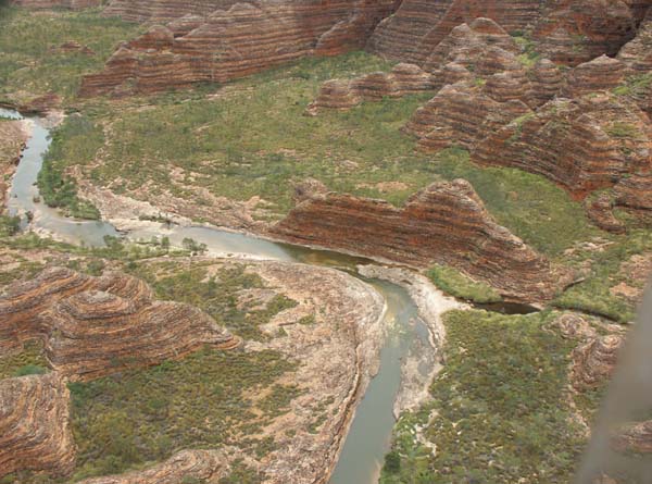
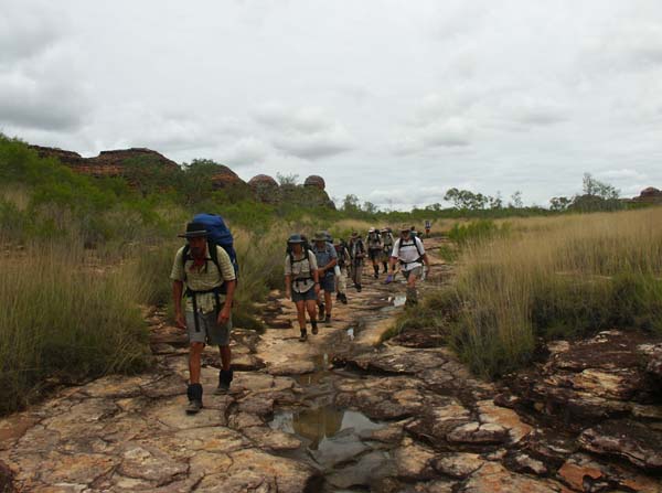
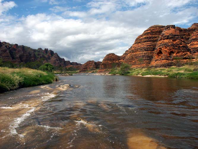
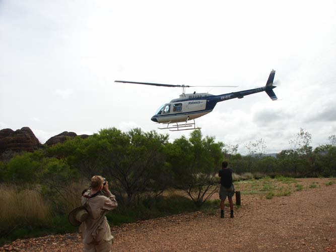
Click the photos to see enlarged versions. Click your back button to return to this page. Hold your mouse pointer on the photos to see captions. 2008 was the wettest it's been for at least five years. This trip was so amazing that we felt we had to put a selection of photos onto the web site as fast as possible. We hope to improve this gallery later in the year. With so much rain, the airstrip was closed so we flew in by helicopter. The photo at left below shows an aerial view of Piccaninny Gorge -- water everywhere. The photo at right shows the start of the walk. Even the short trail from the car park had water on it. | ||
 |
 | |
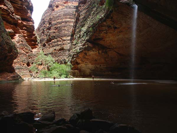
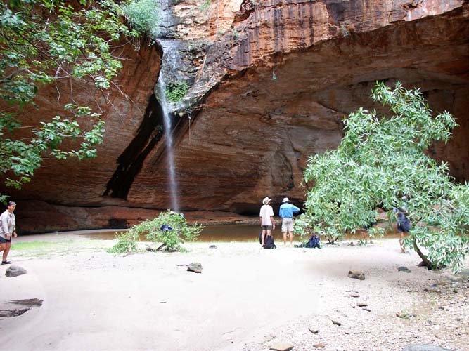
| The walk to Cathedral Gorge was well and truly under water. The photo at right below was taken from behind the falls looking back.. | ||
 |
 | |
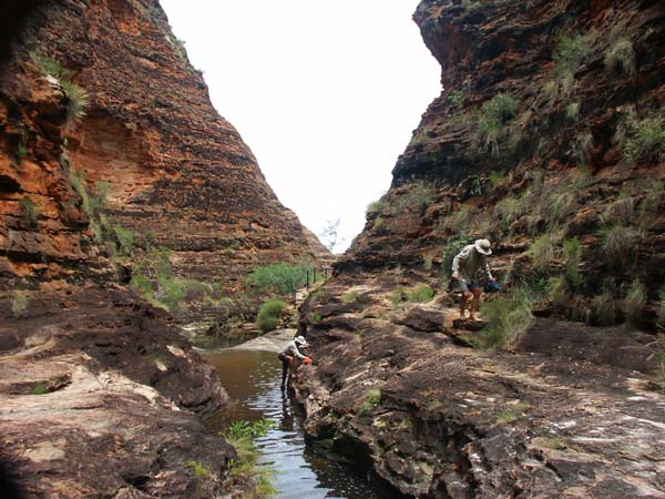
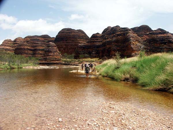
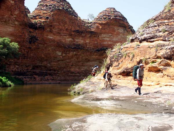
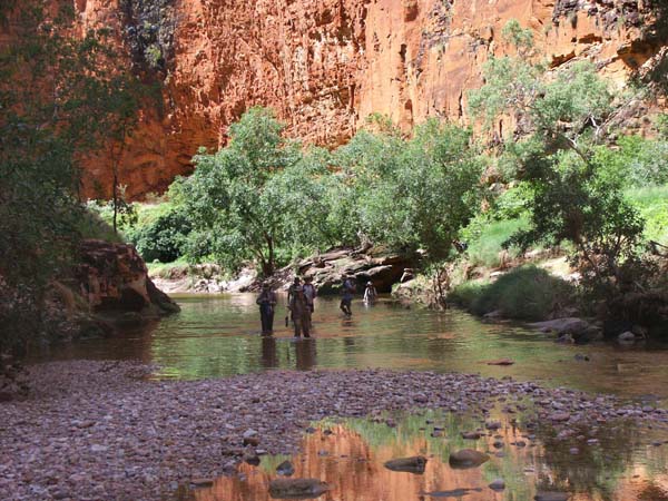
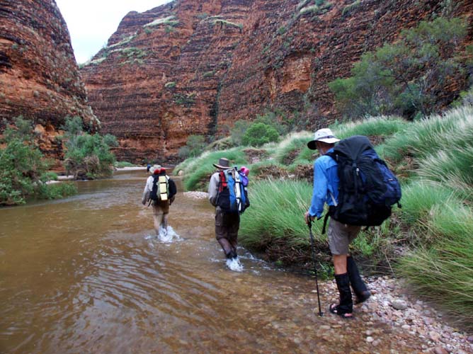
| There was a lot of wading as we moved upstream along Piccaninny. | ||
 |
 | |
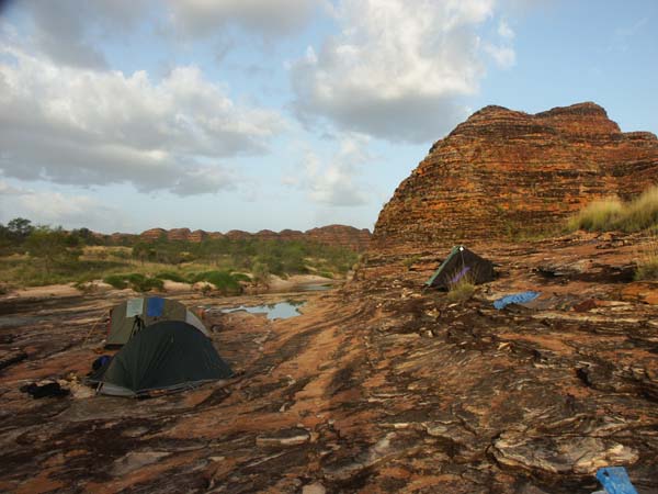
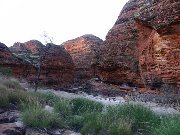
| We had an easy day and made our first camp on some rock ledges not too far upstream. The pools were great as was the late afternoon shade. |
 | |
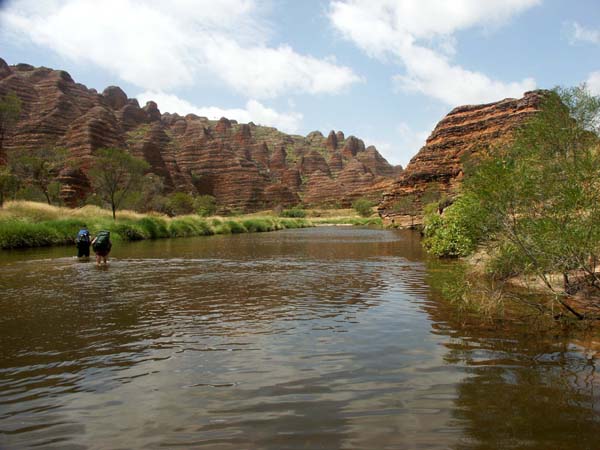
| Moving on the following day, there was still a lot of wading but there were some good dry sections as well. | ||
 |
 | |
 |
We dropped our packs at a high camp site before the elbow and wandered along to Black Rock Falls. The photo at left shows Black Rock Creek where it joins Piccaninny. | |
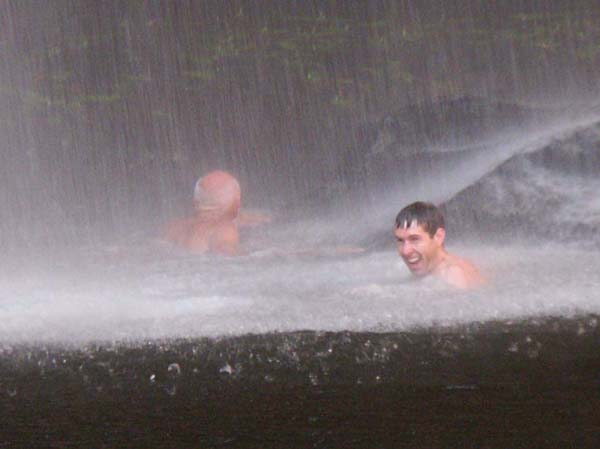
| Black Rock Pool is the best permanent source of water in Piccaninny, but few people have seen it with the falls running. Fewer still have got to have a shower under the falls. |
 |
 |
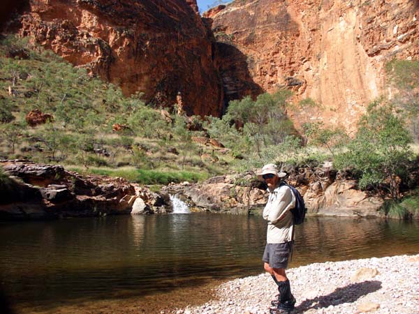
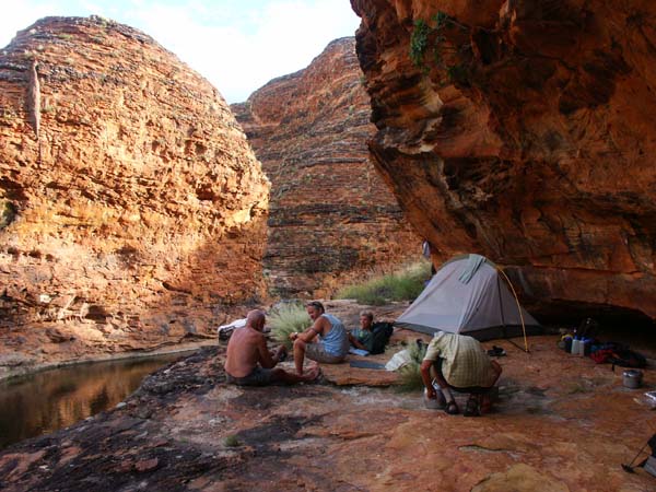
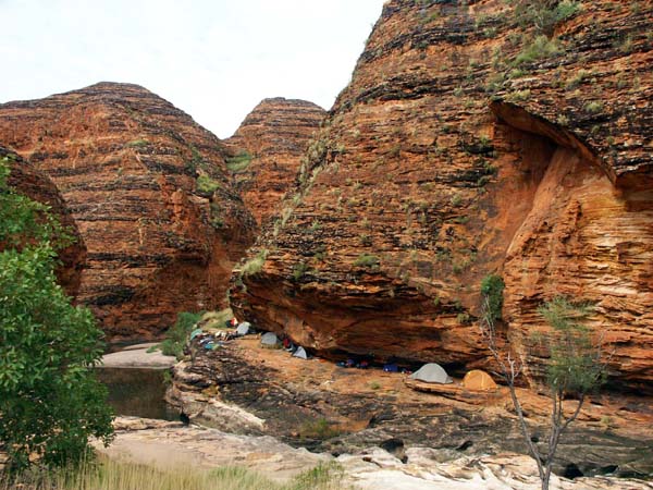
| Our camp was in a partial rock chelter, good shade in the afternoon and an excellent spa for relaxation. | |
 |
 |
| We had a visitor at camp before setting off for an all day walk to the first of the five fingers. |
 |
 |
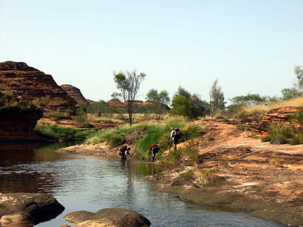
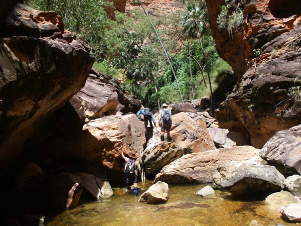
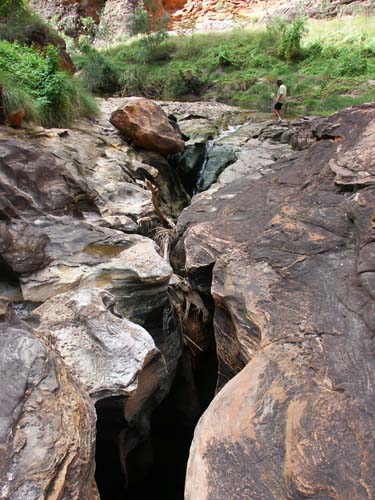
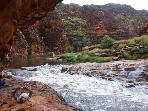
| Above Black Rock Junction, there was a lot of wading and even some scrambling. | |
 |
 |
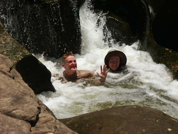
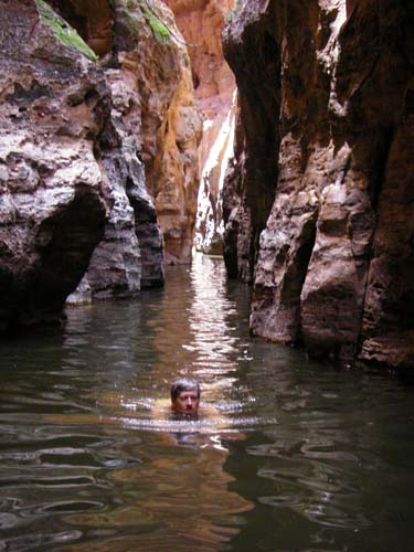
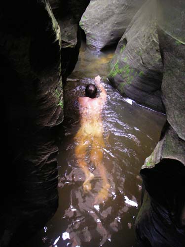
| Hypothermia Gorge takes its name from the very cold water in the gorge. In very dry conditions, youcan walk up. In the cool months when the water is still present, it's too cold for most people to make it through. The water was warmer so we had a go. Two of us made it all the way, in the water (with a few brief rests as we scrambled over a few rocks) for almost two hours, almost hypothermic when we got out. An amazing adventure. The first two photos below show the Hypothermia swim. The third shows Piccaninny upstream of Hypothermia where the creek drops into a small gorge within the gorge. |
 |
 |
 |
| We made our way back to camp in the sun. Then it rained. The two photos below show the camp before the rain and after it began. We hastily moved the tent on the far side of the creek over to join the rest of us. | |
 |
 |
| The following day was for whatever each person wanted. Some went up to the second finger, some went back to Black Rock Falls, and some chose to laze around at camp. After the rain the night before, Black Rock Falls was flowing better than it had been on our first visit. |
 |
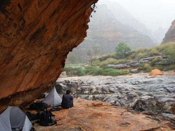
| That afternoon it rained. The two photos below show the camp before it rained and when the creek was nearing peak flood. Our gentle spa had completely disappeared. We, however, were high and dry. | |
 |
 |
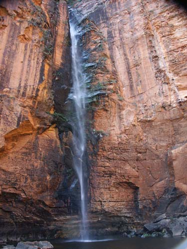
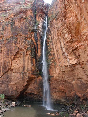
| With the rain, waterfalls appeared everywhere. Some disappeared again as soon as the rain stopped. Others persisted for hours. The waterfall you can see in the distance above right is shown closeup at left below. That waterfall had not had a drop coming over it a few hours earlier. The photo at right was taken in the last of the twilight. Already the creek has dropped substantially. | |
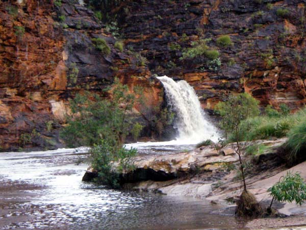 |
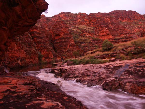 |
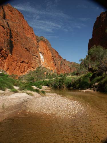
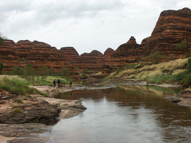
| Although Piccaninny had dropped substantially after the rain, there was still more water then there had been on our way up. | |
 |
 |
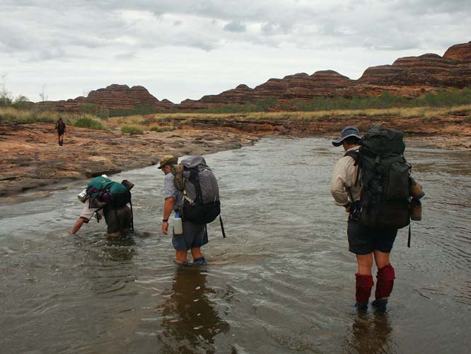
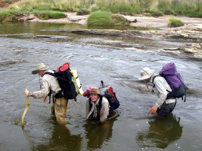
| We crossed and crossed and crossed again as we continued downstream. Sometimes the crossings were shallow and easy, other times deeper and not quite so easy. | |
 |
 |
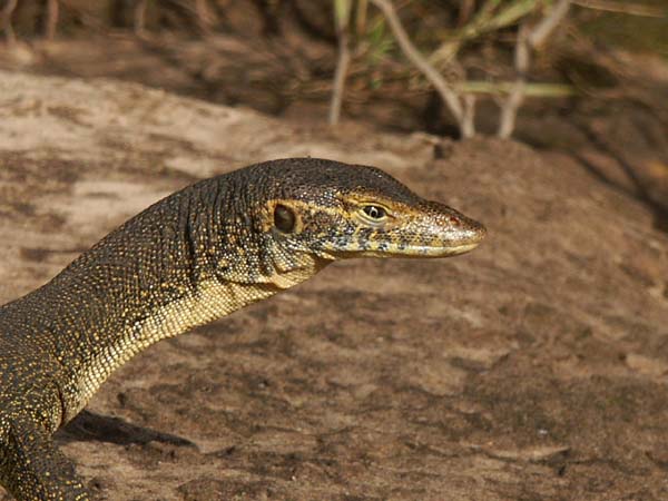
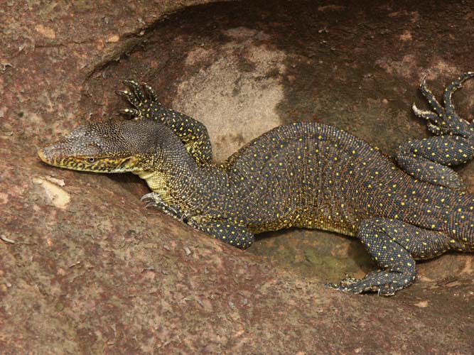
| Back at the end, we had to visit Cathedral again. On the way in we found yet another water monitor. The guide, Russell, saw more water monitors on this trip than he'd seen on all trips in the previous three years combined. | |
 |
 |
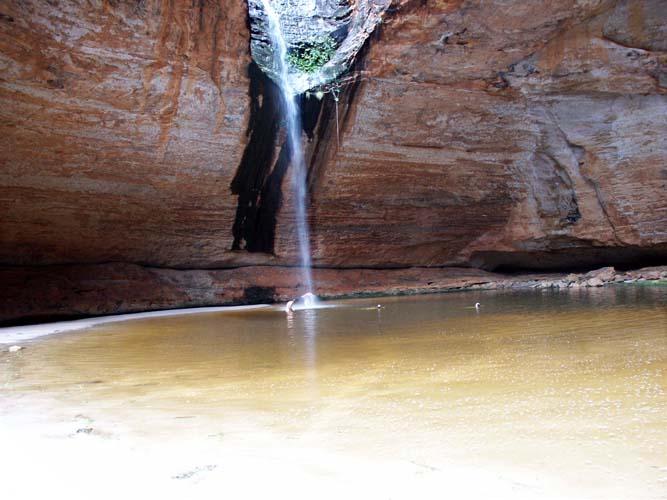
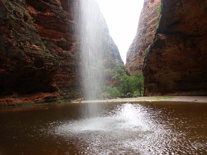
| Cathedral Falls was flowing more than it had been on our way in. needless to say, a swim proved irresistable. You might have to click to enlarge the pictures to see the people. That shows how large it is. | |
 |
 |
| On the final morning, we enjoyed a final view of Piccaninny Creek before boarding the helicopter that would take us back to civilisation. The trip was over, but the memories would last a lifetime. | |
 |
 |
Want more info? Click here to download a PDF file of our Wet Season Bungles trip notes.