Kakadu Circle No. 1, Section 1: Koolpin to Jim Jim, May 2006
Photo Gallery and Report
Click the photos to see enlarged versions. Click your back button to return to this page. Hold your mouse pointer on the photos to see captions. Special thanks to the various participants for the use of some of their photos and comments.
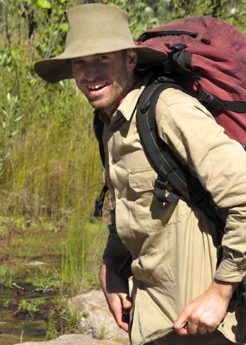
This was a special trip to celebrate 20 years of Willis's Walkabouts. May offers the perfect compromise between the torrents of the Wet and the idyllic weather of the Dry. A very late Wet meant that it was even better than expected. By putting in a food drop before the roads had closed for the Wet, we were able to do a full three weeks and enjoy Jim Jim and Twin Falls before they were open to the general public. It was the best way I (Russell Willis) could think of to celebrate 20 years of leading Willis's Walkabouts trips in Kakadu.
The second half of this trip is on a separate page.
What was it like? The photos can only tell a part of the story, so I'll begin with a quote from one of the participants.
"A totally unique experience, completely different walk to any I have done, to spend three weeks in a tent with no fly and not wear a rain coat, swimming every day and cooking on a camp fire, the starry nights ... just magic." Margaret Law, New Zealand.
|
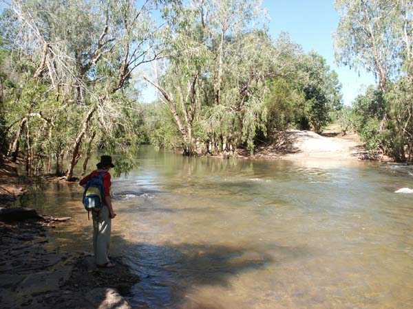
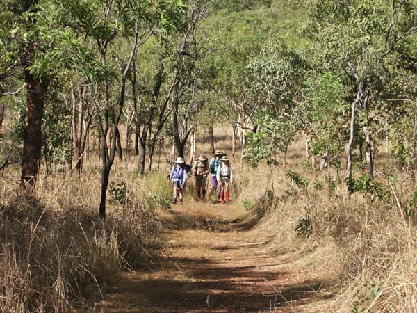
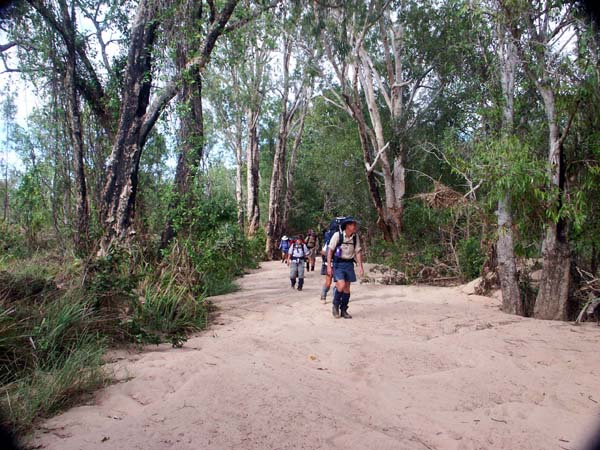
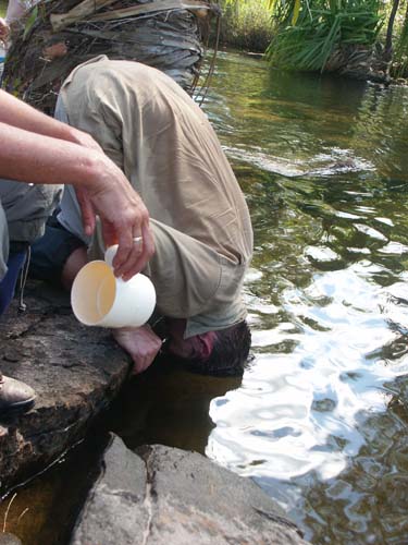
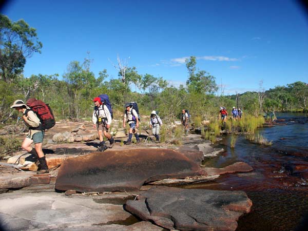
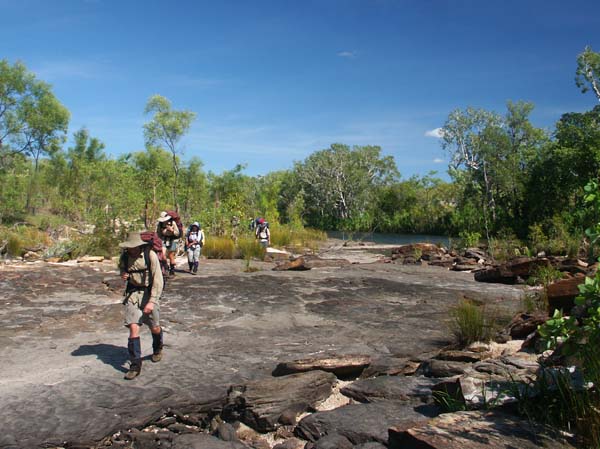
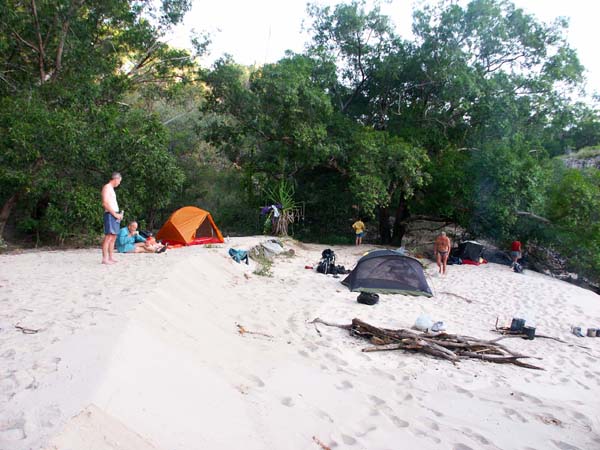
Day 1 We collected the group from their various accommodation and headed off down the track, finally arriving at Flying Fox Crossing a bit after 2 pm. As you can see in the photo at right, the water was rushing across the ford and there was a huge sandbank on the far side. No vehicle was going to get through the South Alligator River so it was time to don our packs and head off upstream. |
 |
| The first part of the walk wasn't too difficult, but, with the river higher than normal for this time of year, there was one tricky bit before reaching our first campsite on Koolpin Creek above the junction with the South Alligator. Less than three km and we were done in time for a pleasant relax before dinner. |
 |
 |
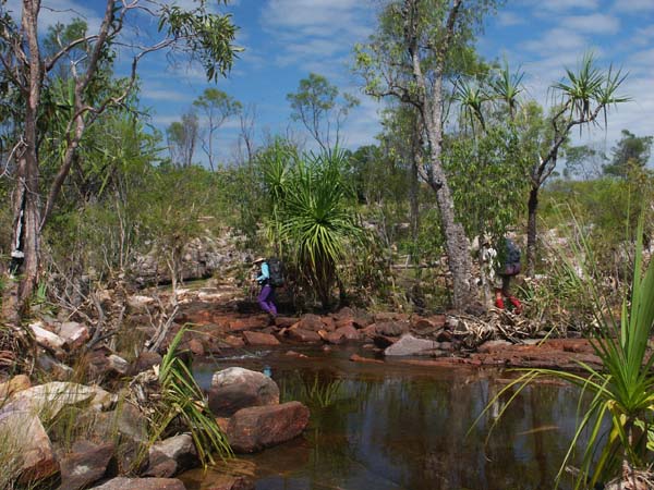
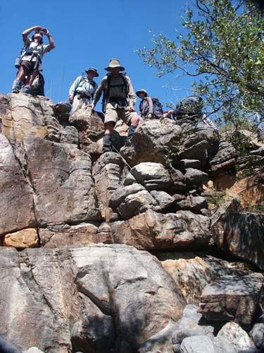
Koolpin Creek was high enough so most of the group chose to use the remains of the old bridge to cross Koolpin Creek -- this was with the most difficult part of the entire three weeks. With the 4WD track still closed and plenty of water everywhere, we decided to follow the track to the gorge so we could get to the best parts as quickly as possible. | |
 |
 |
Safety first! We knew that Koolpin had not been checked for crocodiles and that there was no barrier to their getting there during the wet season so we chose to climb over a ridge and rejoin the creek above the first waterfall. (Sure enough, a big croc was removed from Koolpin before it was opened to the public a couple of weeks later.) Big crocs don't climb waterfalls so we knew that we'd have no problem from here on. The climb was somewhat strenuous but it was short and rewarded with some stunning views. |
 |
 |
 |
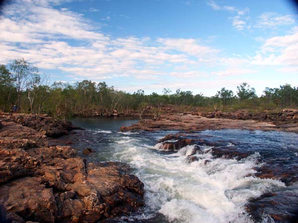
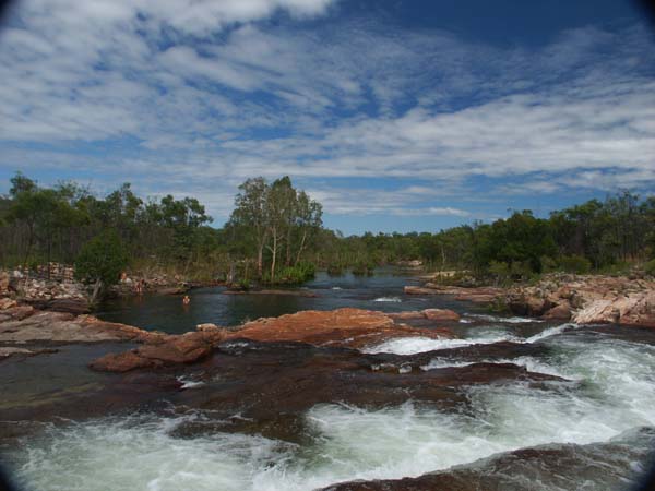
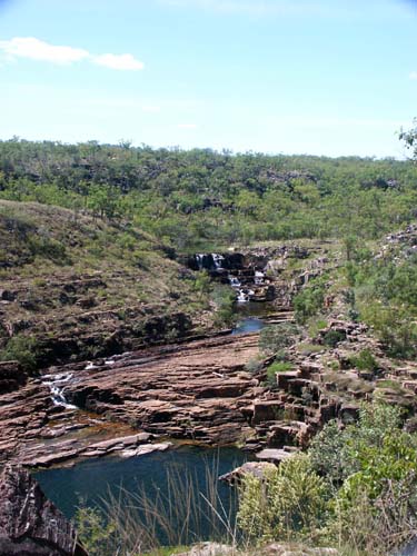
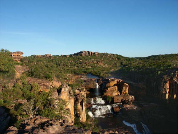
| Waterfall followed waterfall as we worked our way up the creek. The falls don't flow like this when the vehicle track is open. | |
 |
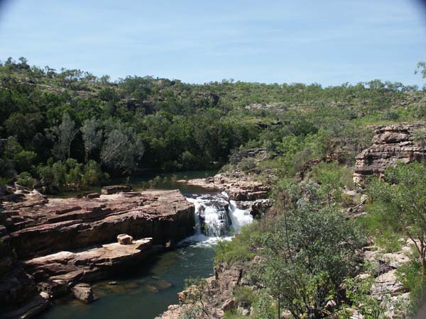 |
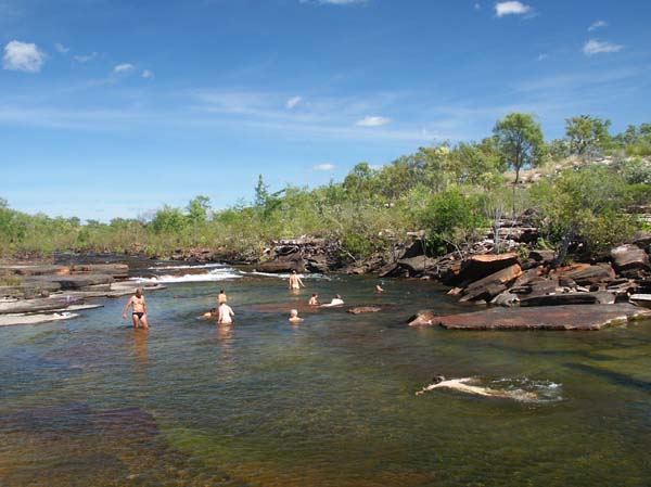
| After a lunch break between the two waterfalls shown above, we moved on to our campsite, a white sandy beach next to a beautiful pool. Time for another swim. | |
 |
 |
Day 3 | ||
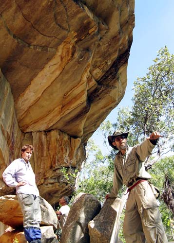
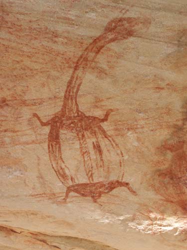
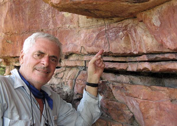
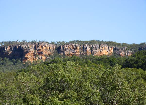
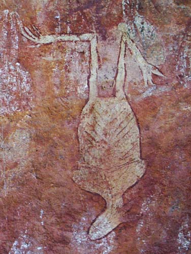
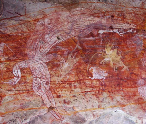
Koolpin Gorge has one of the greatest collections of Aboriginal rock art in Kakadu. The paintings are not, however, easily accessible for day trippers so most remain unknown to the general public. The photo at right shows some of the group at a high art site. Guide Russell Willis is pointing out something upstream. The photo at far right shows a painting of a long necked turtle. |
 |
 |
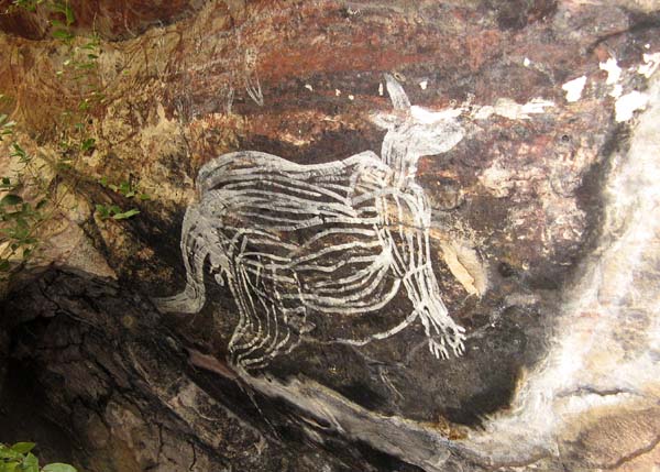 |
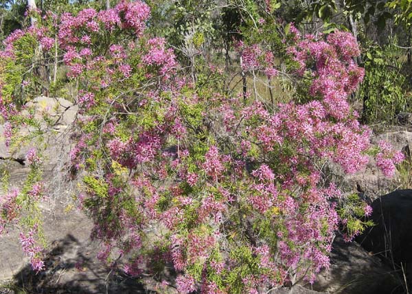
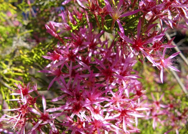
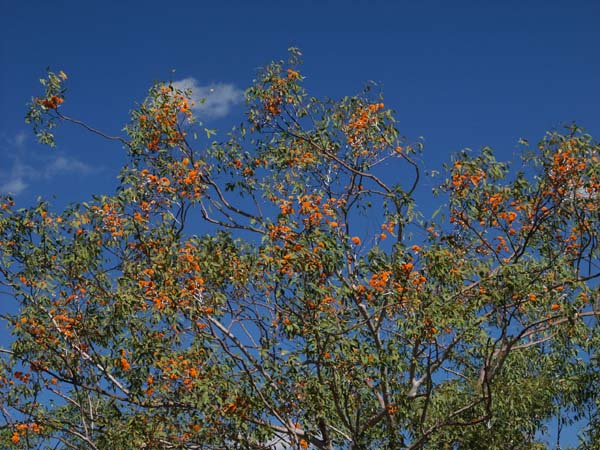
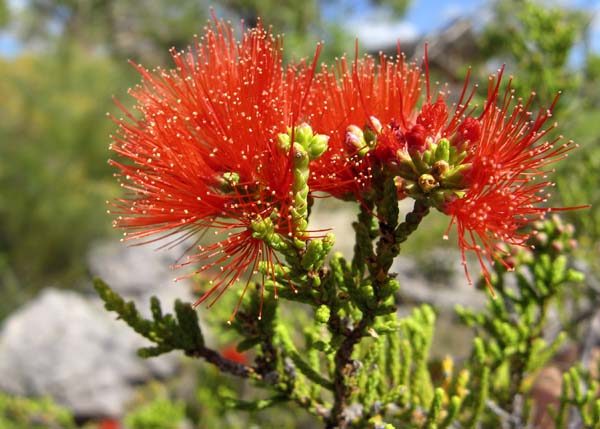
The Aboriginal traditional owners of Kakadu believe that images of some paintings should not be published where they can easily be seen by unauthorised persons. For this reason, we have restricted ourselves to paintings of things like animals and of paintings which have been widely published elsewhere.We can, however, tell you that we visited 7 or 8 different art sites before lunch on day 3. Kakadu is much more than waterfalls and art sites. The turkey bush (Calytrix extipulata) flowers were as good as we've ever seen them. The two photos below show the full bush and a close up of the flowers. |
 |
 |
| After lunch next to a big pool at a creek junction, we wandered on for another hour to find our campsite. Another pool, another cascades, another perfect spot. The trip was beginning to resemble our own little bit of paradise. | |
 |
 |
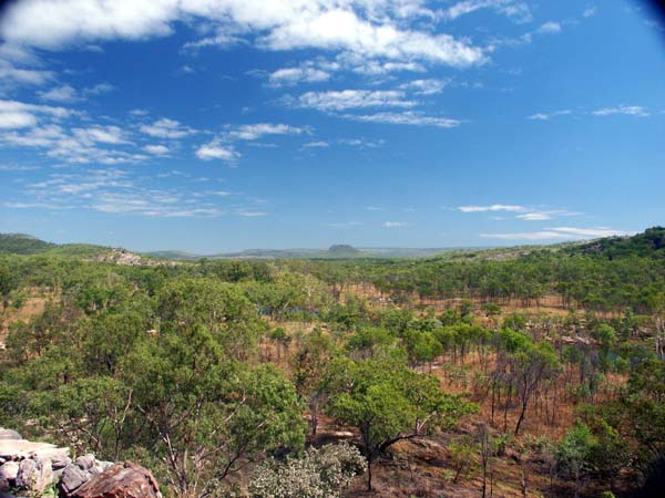
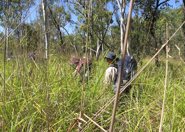
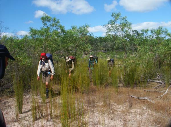
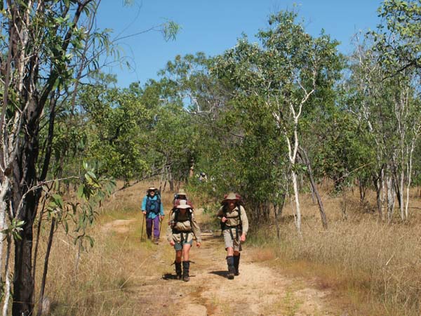
Day 4 What a day! You name it, we had it. We began with a nice easy walk along a flat rock ledge. Soon we were walking through thick grass. | |
 |
 |
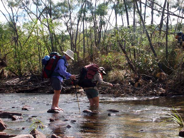
| We walked along a sandy, dry flood channel in the river bed. We waded across a small creek. | |
 |
 |
| We had to do some rock hopping and .... of course .... we had to stop for yet another swim. And this was only time for morning tea. | |
 |
 |
| We stopped for lunch below a high art site. The two photos below show John Mayze, the source of many of the photos on this page, next to a painting of a freshwater crocodile and the view from the art site. |
 |
 |
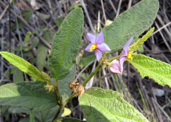
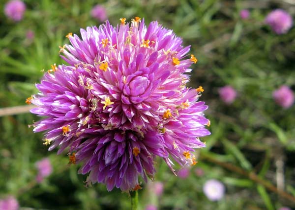
| John and his friend Jane took some magnificent flower photos. I'm not sure who took which, but John sent us the CD so he gets credit in the captions. The two photos below show a wild tomato and a bush everlasting (Gomphrena canescens). | |
 |
 |
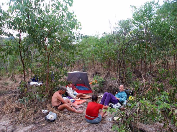
| This was a very long day and hot heads needed to be cooled off. We ran out of time and had to choose a scrubby camp site, but even here we had a good pool nearby. At this time of year, you have to work to camp somewhere where you can't have a swim on the Kakadu plateau. |
 |
 |
Day 5 | |
| This was our last day on Koolpin Creek. Most of the walking was fairly easy so it was a good day to wander along, stopping to photograph the natural world around us, to relax and enjoy the environment through which we travelled. |
 |
 |
 |
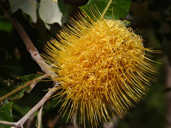
| It was a good day to enjoy the flowers. Because of the late finish to the wet season, we not only had more water than normal, we had a variety of flowers like the banksia, right below, blooming later than normal. The eucalypts were right on time and full of honeyeaters enjoying nature's banquet. | |
 |
 |
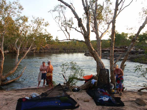
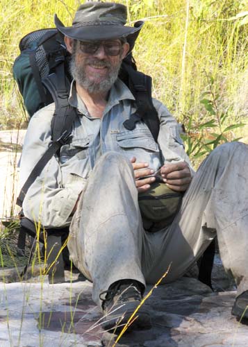
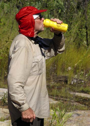
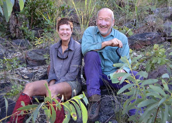
| It was a good time to record some of the characters on the trip. From left to right, guide, Russell Willis, Max having a drink, Cora and Martin. |
 |
 |
 |
 |
| We arrived at our campsite in plenty of time for afternoon tea. No point in moving on -- the next good campsite was several hours away. The couple at right, George and Marilyn, met on one of our trips in 1999, one of many romances to have developed on our trips. Walking with someone for two or three weeks is a great way to get to know them. | |
 |
 |
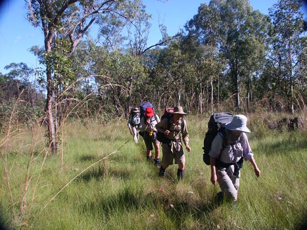
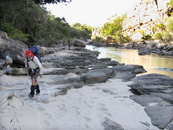
Day 6 To get from the upper reaches of Koolpin Creek to Twin Falls Creek, we had to walk through a broad grassy valley. Sometimes the grass was relatively short. Sometimes it was head high. Usually the ground was reasonably dry, but sometimes it was impossible to avoid wet feet -- the only day on the entire trip where keeping your boots dry was impossible. | |
 |
 |
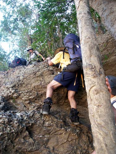
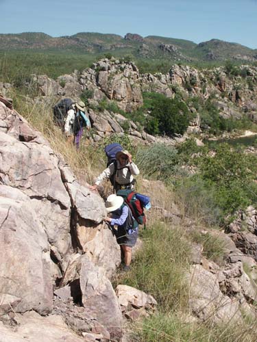
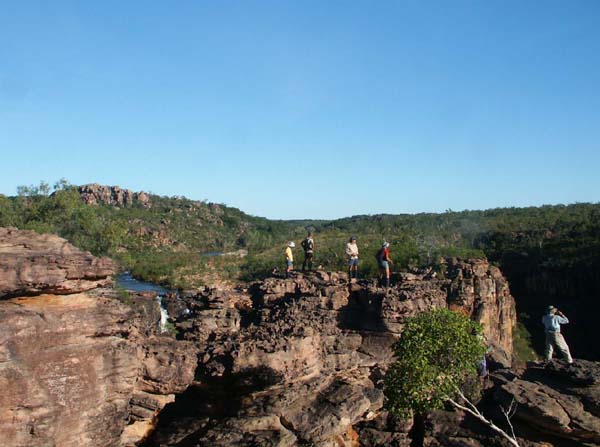
| The sides of the valley were fairly steep but easy to climb so we occasionally dropped packs and went up for a view. |
 |
 |
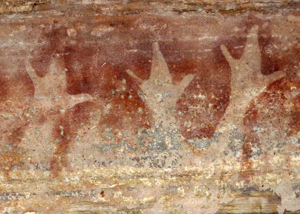 |
We found a variety of art on our climbs. Some we cannot display here but some we can. Some was relatively new like the flying fox shown at far left. Some was ancient like the hand stencils shown at left. According to George Chaloupka, the foremost authority on Aboriginal art in Kakadu, this style of hand stencil is at least 8000 years old, ancient when the pyramids were built. Seeing things like this gives you a real appreciation for just how old Aboriginal culture really is. |
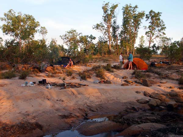
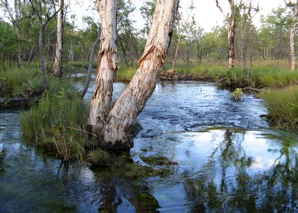
We camped on a tributary of Twin Falls Creek which is too dry to use later in the year -- great to be able to move on at our leisure with no need to push on to find water. Day 7 After breakfast and a relaxed cup of tea or coffee, we moved on toward Twin Falls Creek. After a short swampy section, we hit some of the easiest walking of the trip. | |
 |
 |
We soon hit one of the largest concentrations of Aboriginal rock paintings on Twin Falls Creek. As mentioned before, we can only give you a small taste of what was there. The photo at the right shows the group resting at a rock shelter. The two photos below show a wallaby painting and a crocodile done in the decorative x-ray style. |
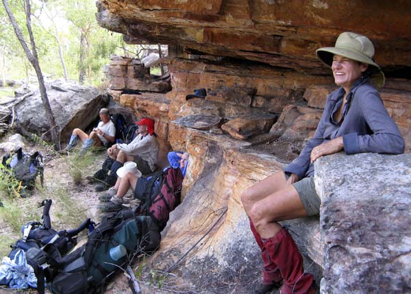 |
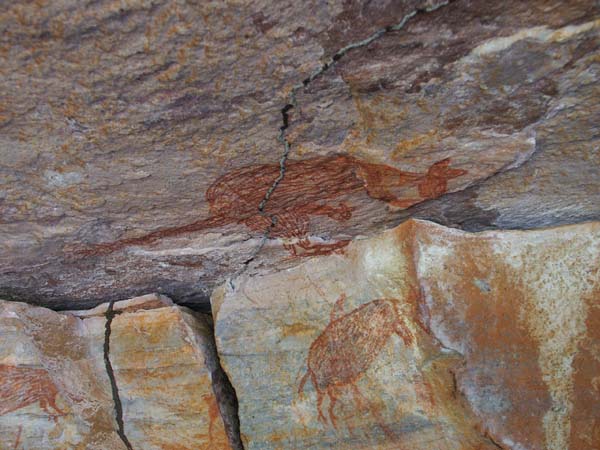 |
 |
 |
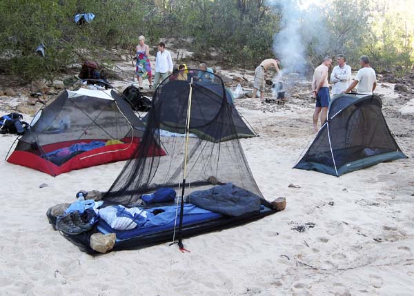
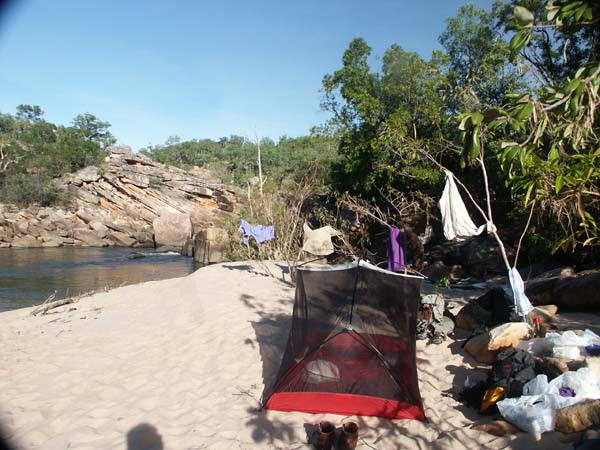
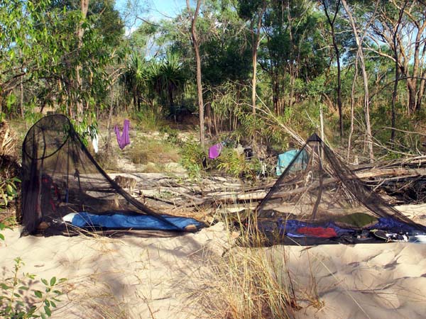
Flowers, flowers and more flowers. The late, record breaking finish to the wet season meant that we got to enjoy wet season flowers as well as those that bloom in the Dry. The photo at left is Petraeomytrus punicea, endemic to the sandstone country in Kakadu and nearby Arnhem Land. This plant is a perfect example of the hassles involved in learning plant names in Kakadu. It is an endemic and doesn't have a common name. Originally it was in the genus Melaleuca, then Regelia and now . It's next to impossible to keep up with the changes. The two photos below show the group wading across Twin Falls Creek and our campsite for the night. A mossie net is the perfect lightweight substitute for a tent when you have weather this perfect. |
 |
 |
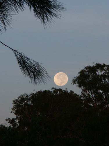 |
That night we enjoyed the full moon. From this point on, the nights would become dark enough so we could enjoy the stars before bed. |
Day 8 | |
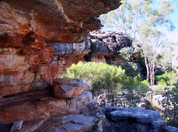
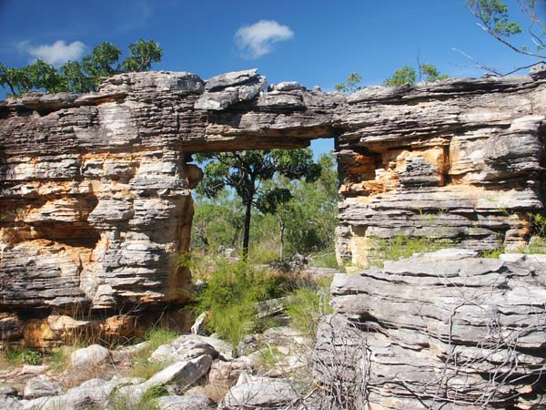
This began as an easy day. The hardest part was crossing the tiny creek shown at right. This would have dried up not long after we crossed it. We soon came to the labyrinth, a magical rock maze with bits of Aboriginal art. We stopped for a short wander. The two photos below can give you a hint of what it was like but no two dimensional photo can do justice to the many rock formations. |
 |
 |
 |
| After our break at the labyrinth, we continued down Twin Falls Creek and had a swim just below a small set of rapids. | |
 |
 |
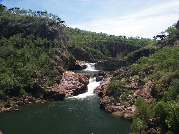
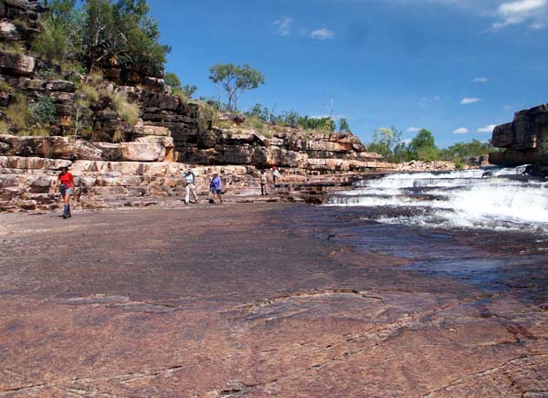
| For lunch we stopped just above the Amphitheatre Falls, one of the most spectacular spots on the walk. The two photos below show some of the group walking down to the falls and a view of the falls from a nearby high point. | |
 |
 |
Climbing around the falls required a bit of a rock scramble as shown left below. This brought us down to the small creek flowing into the Amphitheatre pool from the east (centre below). Two months later, this was bone dry -- a good reason to come at this time of year. Moving downstream to our campsite was quite easy for most of the way, but there was a rather interesting climb as shown at right below. Later in the year, water levels are lower and this section is easier -- a reason to come later in the Dry. Every season has its advantages. | ||
 |
 |
 |
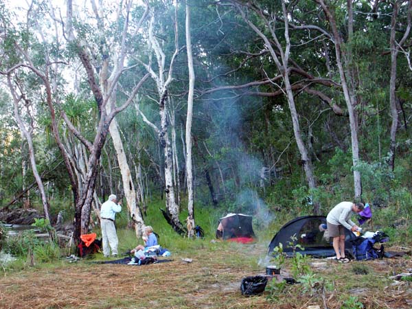
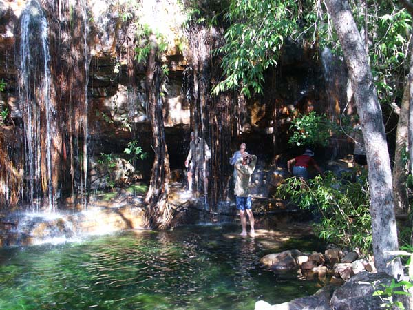
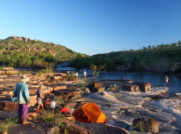
Not far past the climb, we stopped for a shower on a small side creek. This creek has an amazing feature just upstream of these falls. None of the photos came out so, if you want to find out what it is, you'll have to come along ans see for yourself. Not far past the shower, we made camp on a huge sand bank next to a deep pool. Arriving at camp early most days meant that we could relax and enjoy our surroundings. | |
 |
 |
Day 9 | |
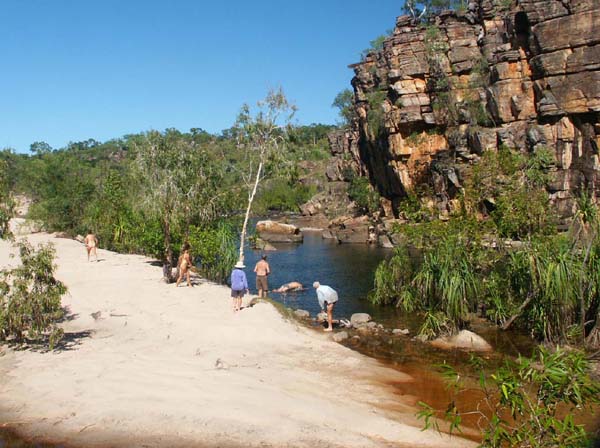
Although there were a few scrambles up and around because of the high water level, most of the day's walking was as easy as that shown at right. The pool shown below was irresistable so a swim was in order. There are few other places in the world where the water is so perfect for swimming and yet pure enough to drink. |
 |
 |
 |
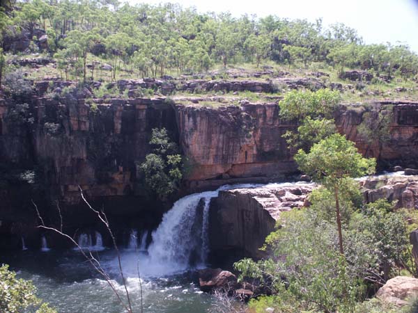
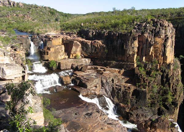
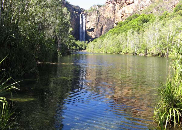
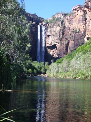
We reached Twin Falls in time for an early lunch and spent the rest of the afternoon relaxing and enjoying the views at the top of the falls. We had the falls to ourselves -- almost. The helicopter shown at left buzzed overhead on several occasions. The people in the helicopter got some great views, but instead of a completely natural waterfall, they got our camp as well. The two photos below show the top drops of Twin Falls, one taken early in the afternoon, the second in the setting sun. We never did get decent light to photograph the final 80 metre drop into the gorge below. (See our Twin Falls Creek Gallery if you'd like a full view.) |
 |
 |
 |
Visiting Twin Falls when the roads are still closed has advantages and disadvantages. The disadvantages are that you can't go up the lower gorge and you can't get a vehicle in to drop you off or pick you up. The advantages .... that's what makes this such a magic time of year. You get to camp right at the top of the falls as shown at right below. You can wander freely to get the best views as shown at left. And, best of all, you share it with no one but your walking companions. This magical spot is yours and yours alone. | |
 |
 |
Day 10 After our night at the top of Twin Falls, we followed the marked trail down to a view point, then down to the car park and along the road. | |
 |
 |
 |
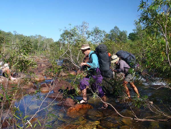 |
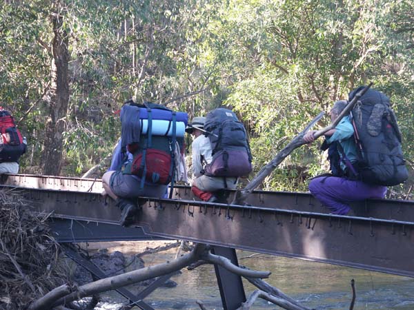
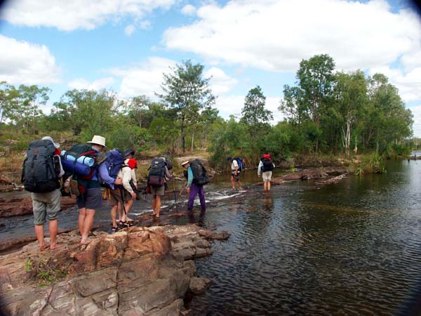
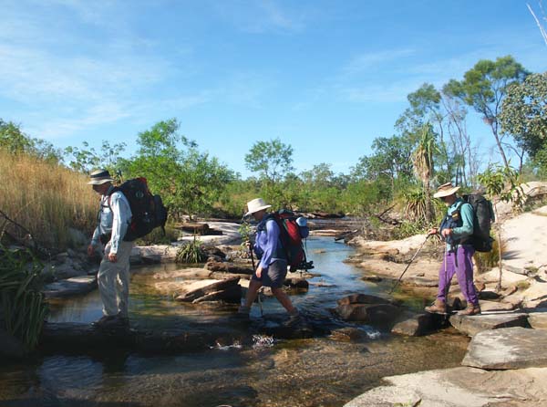
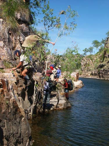
Following the track the entire distance and wading across Jim Jim Creek at the vehicle ford would have been madness -- park rangers removed at least ten large crocodiles from the Jim Jim - Twin area before the road was opened to the public. Fortunately, we knew a safe way. We crossed a small creek on the log bridge shown at far left, then crossed Jim Jim Creek in the shallow, rocky area shown at left. With water that shallow and clear, wee could be sure there were no crocs close enough to be a potential problem. |
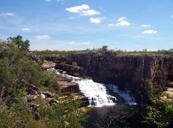
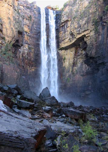
Then, there it was -- Jim Jim Falls. With the road closed, we had it all to ourselves. We got some great views but we always made sure to keep well away from the edge of the large pool where there might have been large crocodiles. The small freshwater crocodiles above the escarpment are too small to present any real danger and will do all they can to get out of your way. The large estaurine crocodiles that inhabit the lowlands move from place to place during the wet season. They can live their entire lives away from salt water so big pools like the ones below Jim Jim and Twin Falls are potentially dangerous until the annual croc surveys have been completed. |
 |
 |
 |
This marked the end of the first half of the walk. We collected our food drop from where it had been carefully hidden months earlier. The food drop allows us to keep pack weights down. It also requires advance planning which is why we cannot run this trip unless we have the necessary bookings by mid November. Photos and descriptions of the second half of this trip are on a separate page. For additional information, please see
Words and photos are no substitute for the real thing. Why not join us and see for yourself? |