KIMBERLEY COAST EXPLORER

March 15 - April 25, 2009

Lower Drysdale River
  • The longest and most spectacular expedition we offer.
  • Above average fitness and a sense of adventure are essential.
  • This is an exploratory trip. Only one of our groups has walked over most of sections 1 and 4.
  • Too long? Each of the four sections can be done on its own.

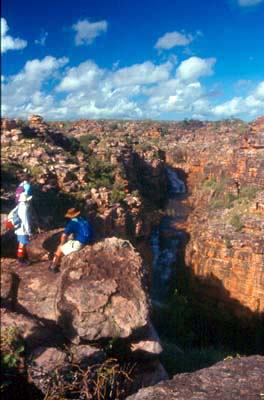
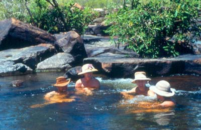
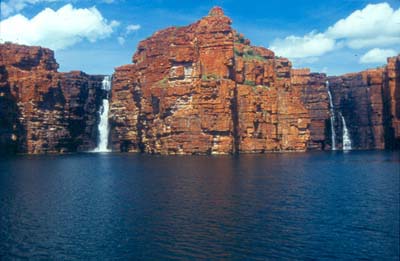
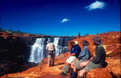
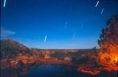
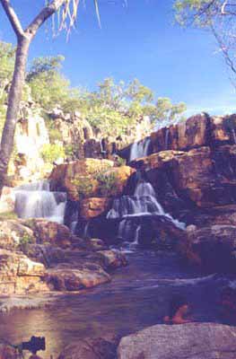
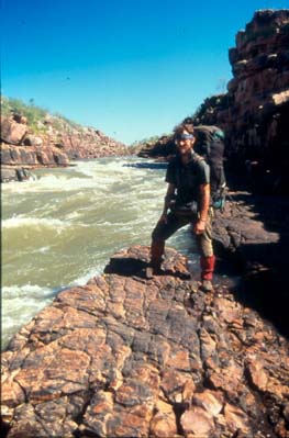
This trip takes you deep into the wilderness along the Kimberley Coast, one of Australia's most rugged and least known regions. By going at the end of the wet season, we guarantee good water supplies and flowing waterfalls, but this does mean that it will be hot and humid. Fortunately, you can always cool off with a swim.

But be warned, trips like this are always subject to change due to weather or other conditions outside our control.

Looking for Aboriginal art sites is an important part of this trip. We will visit the best sites we found on previous trips and search for others. Although it is not yet possible to date most of the paintings, existing research suggests that the styles we see will range from early twentieth century back more than 10 000 years. If you are not particularly interested in the art, you might still enjoy poking around the various rock formations or perhaps you would prefer to relax near a pool and watch the birds or have a swim while others go exploring. The choice is yours.

The pictures show some of the highlights. They don't show the work needed to get from one of these beautiful places to the next.

Seaplane transport at Drysdale River Unnamed waterfall near King George Relaxing in the river

Section 1: East of the Berkeley to King George: March 15-29

We plan to begin with a boat and/or seaplane flight to a point on the western side of Joseph Bonaparte Gulf, southeast of the mouth of the Berkeley River. From there, we head inland to explore the many pools and a spectacular waterfall we spotted from the air on a previous trip.

From here, we walk to the Berkeley River, probably reaching the main falls on about day four. Next, we work our way along along the spectacular 20 km Berkeley Gorge to Casuarina Creek, stopping to explore some of the small creeks and waterfalls along the way. Casuarina Creek leads us through deep gorges, lovely pools and a wide variety of vegetation ranging from dense monsoon forest to sparse sandstone scrub as we work our way to the eastern arm of King George Sound, where we are met by a seaplane which brings in our food drop and those joining us for the second section.

Section 2: King George to Faraway Bay: March 29 - April 8

The highlight of this section is King George Falls where two separate branches tumble between 80 and 90 metres into the tidal gorge below. The photos below give you two views of the falls: one from the boat we will use at the end of this section and another showing a close up of the top drop at the left of the first photo.

King George Falls Top Drop, East Branch King George Falls

We spend our two weeks exploring an area within 10 km of the falls. The terrain is rugged, the gorge impassable so our progress is anything but a straight line. Our rewards include a variety of delightful creeks, cool swimming holes, ocean views and picturesque gorges. On the final full day, a boat comes in to meet us at the beach and take us up King George Gorge so that we can enjoy views which cannot be obtained in any other way. We then continue around the coast to Faraway Bay and spend the night at the lodge there. Next morning, we get a lift to their airstrip where we pick up our next food drop and meet those joining us for the third section. Those leaving here fly back to Kununurra.

Section 3: Faraway Bay to Lower Drysdale River: April 8-18

From the Faraway Bay airstrip, a relatively easy walk brings us to the campsite shown at the right where we find some nice pools and an interesting Aboriginal art site at the top of a small waterfall which plunges over a sheer cliff into a tidal creek. We spend two nights here, enjoying the special treats that come in with the food drop and doing a day walk to another interesting creek and more Aboriginal art.

Night view of Waterfall campsite

These easy days are followed by a much longer and more strenuous one as we make our way west to a major north-south creek. Much of the route is fairly flat, but there is some rough country and a substantial distance to be covered. Once we have reached this creek, we follow it north to where it drops 30-40 metres over a cliff into a tidal gorge. Immediately to the west, a smaller creek cascades down into the same gorge, just one more of the unknown wonders of the Kimberley Coast.

From here, we work our way west to lower Drysdale River. We may choose to follow one of the routes we have used in the past or we may choose to explore further afield in the hope of finding something more interesting. Whichever we choose, we eventually reach a nice sandy camp just above the Alligator Air fishing camp. Next morning, those finishing with this section fly back to Kununurra on the plane which brings in those joining for the final section.

Section 4: Drysdale River to Kalumburu: April 18-25

Unnamed waterfall near Drysdale River

Immediately upstream of the fishing camp, we find a labrynth of broken rock through which we have to pass to reach the lower gorge on the Drysdale River where flood debris 20 metres up on the cliff tops gives mute testimony to the awesome force of the river in flood.

From here, it will all be new to us. It looks interesting on the map. Other than that, we have no idea what we will encounter as we work our way wqest to the Aboriginal community of Kalumburu where we meet the plane which returns us to Kununurra.

Terrain and difficulty. This is the longest trip we offer. It is also one of the most strenuous.

Although we will be averaging less than ten kilometres per day, some of the areas through which we will be travelling are quite rugged. This, combined with the need to carry up to two weeks worth of food, makes good physical fitness absolutely essential.

Besides the above average fitness, you need the ability to swim, a sense of adventure and a desire to explore one of the least known wilderness areas in Australia.

You do not, however, need to be a superman or superwoman. Some of those who have done previous trips were in their mid to late 50's, a few of the younger participants had never done a walk longer than three days.

The trip includes a lot of rock hopping with a full pack on and even a bit of clambering over large boulders. Anyone who has done some off-trail rock hopping is unlikely to have any problem with the terrain.

We expect warm to hot conditions, possibly quite humid at times, with relatively little rain for most of the trip. However, the weather is completely unpredictable at this time of year. Since 1992, we have encountered the tail ends of three cyclones. The edge of Cyclone Chloe in 1995 poured rain on us for a full week and turned the landscape into a quagmire. In 1998, we didn't get a cyclone, but we did get one incredible overnight storm where we had strong wind and over 200 mm of rain. In all three cases, the rain turned the coastal waterfalls into some of the most spectacular sights ever seen on any of our trips.

Your rewards are waterfalls, wildflowers and an incredible Kimberley wilderness experience no other operator can offer you.

This trip spans the transition from the wet season to the dry season. For more information about bushwalking in the wet season, click the link below.

The Wet Season

Click here to see a PDF file of the detailed trip notes.

Click here to see a story written by one of our clients about a Kimberley Coast trip where we were hit by the edge of a cyclone.

Click here to see a photo gallery from the trip mentioned above.

For more information about this trip or to find out how to book, please click the link below and send us an email.

Kimberley Coast Explorer Information


If you know someone you think would enjoy this trip, please click the link below to send them a link to this page.

Forward to a friend