Pearson River and Beyond

Click the photos to see enlarged versions. Click your back button to return to this page. Hold your mouse pointer on the photos to see captions. Please be patient while the photos load.

All photos in this gallery are courtesy of Robin Baillie and Jopie Bodegraven, two of the walkers who let us know about this area.

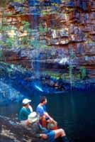
Not too long after leaving the vehicle, we enter the gorge country. Falls and pool near the beginning of the gorge, R Baillie Near the start of the gorge, R Baillie
The two photos below show walking on rocky ground near the gorge and approaching the site of the first pack float. The photo at right is another view of the pack float site. The people who climbed around found it much harder than those who floated through. Go up or float through, J Bodegraven
Walking along the creek, R Baillie Gorge float site, R Baillie
Not far past this comes the most spectacular campsite of the trip.
Rock ledge camp site, R Baillie Another view of rock ledge camp site, J Bodegraven
Just past this camp is a pack float or deep wade depending on water levels and how carefully you can stick to the ledges.
Narrows entry, J Bodegraven Another view of the Narrows entry, R Baillie
The light on the gorge cliffs can be really beautiful. It is, however, hard to capture on film so the photos below can only hint at what you may see.
Light on cliffs, R Baillie More light on cliffs, R Baillie
Some of the walking is quite easy as shown below.
Easy walking, R Baillie Like walking on a footpath, R Baillie
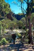
The country opens out as we near the end of the gorge. If your look carefully, you can see one of the walkers in the photo at the left below.
Nearing the end of the gorge, R Baillie Still further toward the end of the gorge, R Baillie
We reach the junction with the largest river in the area where we turn upstream and begin our return back to the vehicles.
Junction with the main river, R Baillie Lunch spot near the river, R Baillie
Depending on how we are going for time, we may do a walk to the lovely waterfall on a side creek shown at right. Saving Grace Ralls, J Bodegraven
Leaving the main river, we follow another creek which brings us back to the track where we left our vehicles.
Junction of main river and Return Creek, R Baillie Return Creek campsite, R Baillie
Many thanks to Robin and Jopie for the use of their photos and their notes on the walk.

Click here to go to the page describing our Munja Explorer trip.

Click here to return to the main Charnley-Munja page.

Click here to return to the gallery page if you want to see photos of the Munja Track and the land it passes through.